Mount Elgon National Park straddles the eastern border of Uganda and Kenya places along the slopes of the Mount Elgon. The mountain region covers the largest foot base in the world, and Caldera, the extinct volcano is one of the country’s oldest features, is said to have first erupted over 24 million years ago, before the eruption, the mountain used to be east Africa’s highest mountain region, the weathering, and erosion has had it to be ranked 4th in the east African region, its highest point is known as the Wagagai, the size stretches 1121 square kilometers at an altitude of 4321m above sea level it was gazette as a national park in the 1992 its largest part is mostly found in Uganda the national conservation area is managed by the Uganda Wildlife Authority.

The forest region grows along the slopes of Mount Elgon the mountain was formed as a result of volcanicity and is regarded as a Dormant Volcano. It is a transboundary conservation area that has been declared a UNESCO world heritage site, it is home to 2 authentic tribes of the Bagisu and Kalenjins of eastern Uganda, the Bagisu refer to the mountain as Masaba known to be an ancestral home of their first king, the mountain is major water catchment area of the surrounding communities, it has got a rich vegetation region comprised on the montane forest, bamboo, alpine, health, and moorland, the region is home to a few animal species including forest elephants, buffaloes, waterbucks, antelopes, primates like vervet monkeys, olive baboons, red-tailed monkeys, defassa waterbucks, and over 200 species of birds in the park.
Mount Elgon National Park is a volcanic mountain climbing region, the most popular being the Sipi falls found at the foot base of the mountain, the trail walks through the mountain present an opportunity for you to explore the caves, angelic cliffs, and many waterfalls, climbing mountain Elgon is less expensive compared to other Ugandan mountains, the highest peak of the mountain is Elgon, hiking the mountain takes 4 -6 days to reach the summit there are three main trails and beginning points to reach the summit of the destination, the Sasa trail beginning in Budadiri, the Pisa trail and the Sipi trail hikers can choose one of the trails to go on venture while in Uganda, hikers register at the migration office in Mbale or the one of Budadiri.
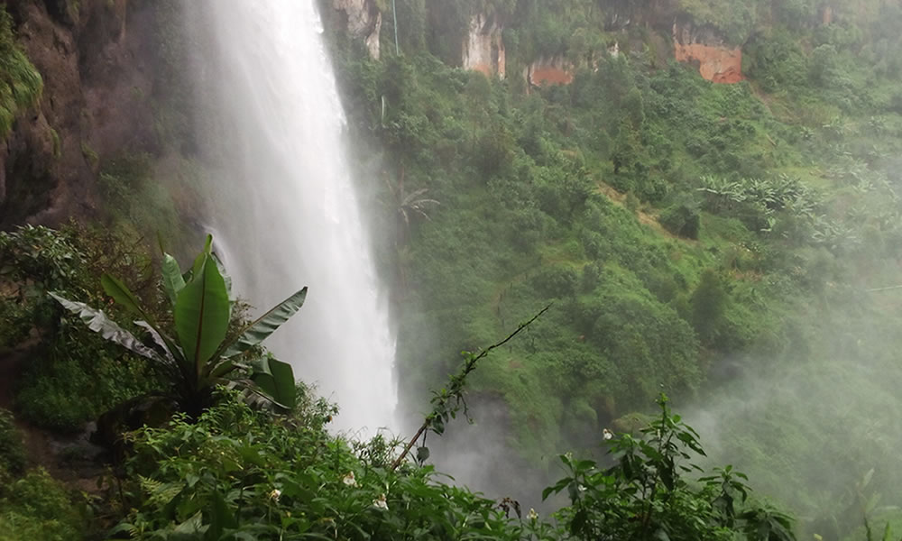
Hiking the Sipi fall, are the most attractive waterfall in eastern Uganda, they are placed a few kilometers from the Kapkwai exploration center, reaching the falls involves hiking through the small villages through banana and coffee plantations they are three hikes although some may seem strenuous, it is possible to hike all the three in one day, other falls include Chebonet, Sisiyi and Wanale, other things to do in the national park include rock climbing, descending Sipi Falls, guided nature walks beginning from the Kapkwai exploration center, birding in the national park to mention a few. The conservation area is placed in the eastern part of Uganda stretching in the districts of Mbale and Kapchorwa, it is approximately 6 hours’ drive from Kampala or Entebbe, visits to the national park can be combined with other destinations for example the Pian Upe, Matheniko and the Kidepo Valley National Park along the northern circuit.
